Pling
Internship: GeoData AS
Year: 2023
Length: 5 weeks
Member: Kristina Hanitz, Eline Vaagan, Iver Gustavsen, Magne Tenstad, Torje Fostås, Tobias Lømo
When we were working on this project, extreme weather 'Hans' brutally hit the country. We now all have an understanding of how extreme weather has consequences at a local level, but also opens up the importance of limiting the damage. How do you avoid being one of those whose house is on the front page of VG after being hit by extreme weather?
“How can we increase the information base to make people more resistant to climate change and natural hazards?”
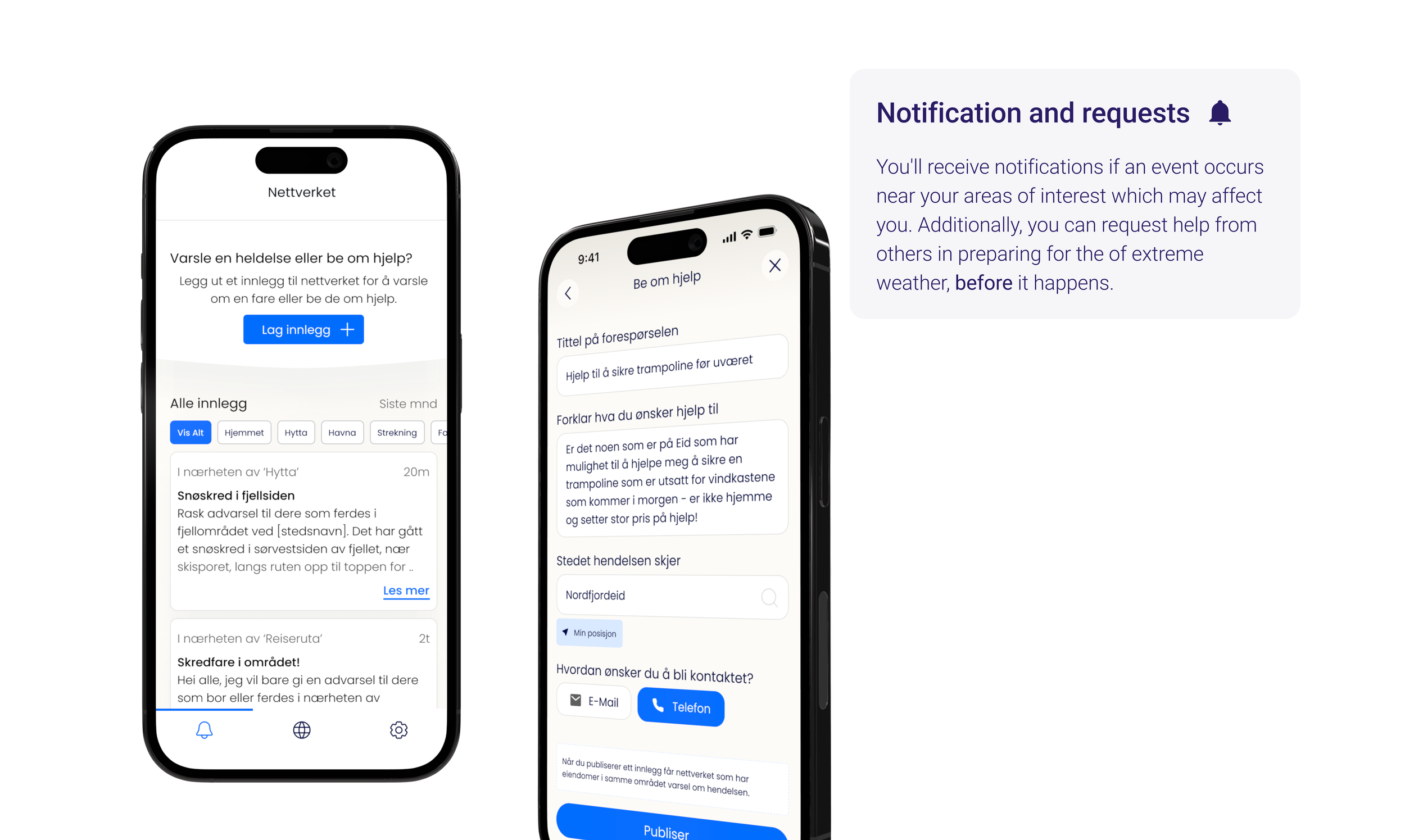
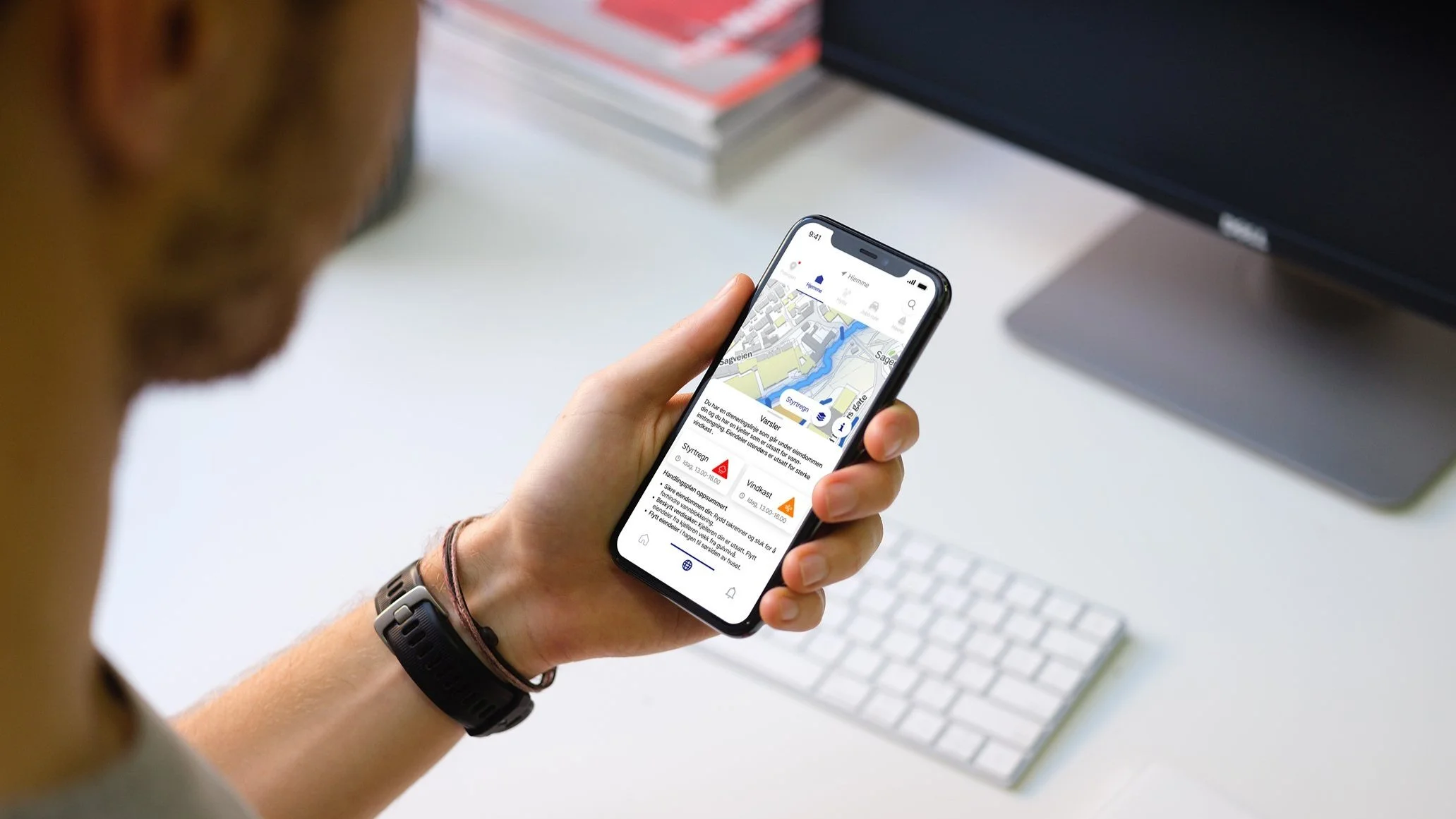
‘Pling’ looks specifically at material damage to property. Thus extra adapted to those who have several points of interest. Our vision is to give the citizen a better understanding of how extreme weather and climate change can affect them at a local level. With access to all of Norway's geographical data and information system (GIS), in addition to property data and metrological api’s, we created ‘Pling’. We extracted data on flood, storm surge, see level rise, torrential rain, extreme temperature and downburst. All consequences caused by global warming. It also uses AI chatbots to generate personalized alerts in addition to machine learning to analyze data and certain objects. The app is now available for those with an ArcGIS account.
My Role: - Responsible for UX/UI📱 - Interviews🙋♀️ - Workshop✍️ - StandUp’s🤝 - Sketching📝 - Testing🤳 - Visual profile🖍️ - Presentation👋 - Research📔 - Mapping📋 - Contribution to map visualization🌍 -
The process
We were an interdisciplinary team, and as the only designer it gave me mainly responsibility for the UX/UI part, and contribution/responsibility in the week with creative-problem-solving and workshop. We all participated on all fronts and where there was a need. The collaboration and contribution in the group was fantastic, as well as contribution from people at the company.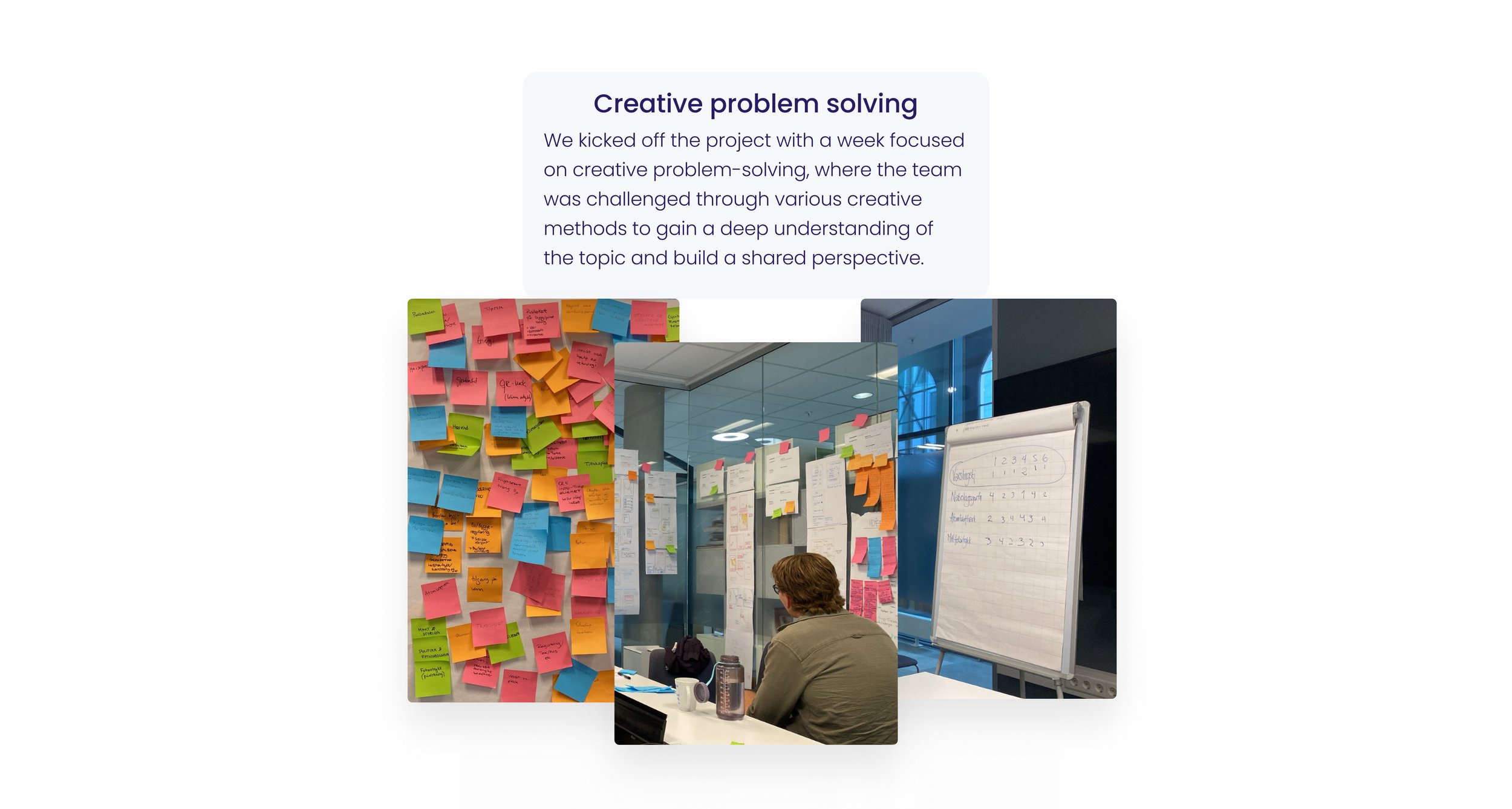


Final Interface